Editor: Mountain Bike Routes | |
What would you like to do today? | |
| < | |
Crag Profile: Mountain Bike Routes |
|||
Details of the crag can be reviewed below. Editing links are present on all routes and inter-route notes |
|||
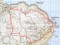
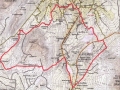
Directions: This is a provisional database of mountain bike routes in the NW of Ireland. You can add your name under first ascent. Also submit a map to Andrew for inclusion in the gallery, and attachment to the route. Ta OS Grid Reference: North West |
|||
|
Introduction I bought my first (bomb damaged) mountain bike in Omagh in the 1980s and, since that time, have watched to sport evolve in a number of ways. Initially, I had no idea what to do with this wonderful piece of machinery. Having failed miserably to cycle up and down mountains, my attention turned to the trails of the north west, which I researched from the OS maps (and my background of hillwalking activities), cycled, and duly logged. Sales of mountain bikes continued apace, but these appeared to have been used largely in urban areas, or within forestry, and a further development was the construction of ‘Custom- built’ trails within the forest providing a variety of colour coded challenges similar to that on the ski slopes of Europe. These are a great, (and justifiably popular), resource, but I always feel that scenery is in short supply within man made forests. The proliferation of forestry sites in the north west means that bikers can get off the road without having to travel too far. It would be impractical to list and comment on each of these. The rides included in this guide are largely non technical excursions into the most remote and beautiful places in the north west of Ireland, and they vary in length from under 2 hours to nearer 10, with as much ‘off road’ as I could manage. I have tried to include worthwhile refreshment stops, but this has not always been possible due to the remoteness of the terrain. Google ‘Mountain Biking in Ireland’, and little or nothing refers to the northwest area, with the exception of Trailbadger. This site gives useful information on the various forestry areas, along with a number of routes, many of which are covered in some form in this guide, with the notable exception of the ascent and descent of Errigal (which I feel is both pointless and irresponsible). There is a Donegal Mountain Biking club, with its own Facebook page. Using this guide Apparently Ireland has a higher percentage of roads per inhabitant than anywhere else in Europe, which means that our thoroughfares tend to be less used, and indeed less maintained. Whilst our nearest neighbour Scotland has relatively few roads, and most of these are therefore busy, it has many more rough trails. These are relatively rare in Ireland and, of the ones we have, our forestry trails are probably the most accessible. This guide endeavours to utilise our dense network of minor roads with a variety of off road trails, to visit some of the most interesting places in our rural landscape. These routes are rarely technical, so colours are used to indicate terrain ‘under wheel’, rather than as a guide to difficulty. Colour Coding. Blue. Surfaced, at least to some extent, possibly liberally laced with rushes or grass. Yellow. Easily cyclable, eg forestry standard gravel track, or custom built walking or cycling trail. Orange. Heavier going, boggy, rocky, or muddy track. Green. Grass or sand Black. Difficult, steep, technical. Equipment Many of these routes are in remote areas, so in addition to having a bicycle equal to the terrain and the skill and fitness to use it, a degree of self suffiency is vital in navigation( competent use of map and compass, GPS or Navigational Ap). In the case of accident or breakdown, a first aid and cycle repair kit should be carried. It being Ireland, waterproof clothing is a must, carry food, water and a torch, and a small rucksack is very helpful for these, and all your other bits and pieces. It cannot be assumed that there will be mobile phone coverage where you need it. Wear a helmet and high visibility clothing. Emergencies. Dial 999 or the EU equivalent 112, will connect you to the emergency services either side of the border. Directions, accuracy and access. Every effort has been made to ensure the accuracy of these route descriptions, but changes to tracks and access can, and will, occur, and the authors are unable to guarantee the accuracy of each detail on an ongoing basis. Directions are based on personal experience and the OS 1:50,000 series of maps, with 6 fig grid references supplied where necessary. Once off the public road, it must not be assumed that every track has a right of access, and whilst we are unaware of any instances of access problems, it must be borne in mind that many of these are on private ground, and virtually anywhere you step off the road in Ireland, you are legally trespassing, whether you are on private land or commonage. In effect, problems are relatively rare, as most farmers and landowners are hospitable, courteous people, and it is important to keep it that way by respecting them, their property, and abiding by the principles of ‘Leave no Trace’. If you are in areas that may be used by walkers or other trail users, keep speed under control, and give way. It is also important to be aware of the situation regarding liability. No one within the Irish legal system has ever successfully sued a landowner for any injury or damage arising from anything 'natural' on his land (or walls or fences either) and several speculative claims have been rejected, so legal precedent is clear. Don’t even think about it, as speculative claims cause scare stories and result in access problems.
Add route description here... |
|||
|
Edit note
Upload a new photo for this note |
|||
01 - Isle of Doagh. Inishowen
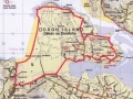 D -
D -Length: 13m Alan & Margaret Tees The Ride
This is for a short winter’s day. The route gives spectacular sea views over Pollan Bay and Glashedy Island, and starts from the comfortable surroundings of the Strand Hotel, Ballyliffin GR C386 484.
1.5 hours, distance 13 km
Terrain
Along the back of the beach it starts grassy, but conditions underwheel will vary, and can include soft sand or round stones. Beyond the castle it is on quiet roads with lovely views.
Approach
North along the Inishowen Peninsula, through Buncrana or Carndonagh to Ballyliffin.
Route
Park at the Strand Hotel, and freewheel pleasantly down the hill in a northward direction to the carpark at the beach Gr 387 495. A grassy track along the back of the beach, makes delightful level pedalling for about 2.5 kilometres, with splendid sea views, to meet the end of a track at Carrickabraghy. The road climbs past the old castle of that name, before descending to Lagacurry (the Craft Village there is worth a visit), with good views over the Lagg (Narrows) and the Knockmany Bens on the other side. Turn inland to Claragh, and descend again to the shore at Doaghmore. This scenic little road follows the coastline around the east side of Doagh Island, with a couple of short hills, to rejoin the main (Well, Mainer!) road at GR 422 498, and then the proper main road at GR 407489 (Lackboy). Two kilometres on this quite busy thoroughfare will bring you back to the Strand Hotel. 1.5 hours 13 kilometres Terrain, Minor surfaced roads, grassy track. Largely level and hills are short. View Route Edit Route Upload a new photo for this route | |||
02 - Culdaff Antiquities. Inishowen
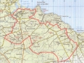 D -
D -Length: 20m Alan & Margaret Tees Inishowen, Co.Donegal Map os 1:50,000 sheet 3
The Ride
This is an interesting area, full of antiquities, which can be linked together by tracks and quiet lanes through old “Off the beaten track” communities. There are fine views, coastal, hill and moor, very little traffic, and the trip starts, and ends, at McGrorys, a small family run hotel, famous for its hospitality, music and food.
Time 2-2.5 hours. Distance ?
Terrain. Minor roads, lanes and unsurfaced tracks, any hills are very short!
Approach.
Through Carndonagh to Culdaff Village.
Route
Departing from McGrorys, turn left and follow the coastal road (a Sli na Slainte) along the river to GR 536 497, past the beach carpark/ childrens’ playpark at GR 547 497. Follow the coastal road past a caravan park, until it turns right, and at this point (GR 553 497) follow the road back uphill, until it joins the Culdaff/ Carrowmena Road. Turn left, and continue along the road for approx 1.5 kilometres, past some mushroom houses on the right, and turn left again, (approx 30 mins from Culdaff) up a lane to Watch Hill (approx 400 metres after emerging on the road) at GR 562 483. The next section is an intricate network of tracks through “claghans”, some abandoned, some still occupied. The laneway twists through some ruined cottages GR 564 485, joining another lane at GR 566 484, where you turn right, then first left, beside a cottage GR 565 483, to another T junction at GR 569 481. Follow this minor tarmaced lane left (north east) towards Bootog to a right angled turn GR 572 483, and then to another T junction at GR 576 478. Turn left, and continue down to another sharp bend at Crockaveela, after which there are more ruined cottages and a further T junction at GR 582 475. This time, go right, then first left (opposite Tremone sign) at GR 580 475, and continue through the hamlet of Ballycharry, to GR 585 469, where the Darcy Magee path is picked up, leading, over a footbridge, and into the picturesque village of Carrowmena, beside the Tremone Bar, GR 591 462. (On this track there is an ancient slab cross at GR 58763 46816). Turn right,through the village, and fork right, to the crossroads at Falmore.GR 584 452. Go straight through, and fork right, turning right, (downhill), again at GR 574 449. This remote track takes you through Tirahork and Cambry, and you turn right at the T junction, uphill and first left to arrive at Glacknadrummond Church, GR 547 473. This area is full of megalithic remains. Turn left at the church, downhill, and straight through the crossroads past Temple Hill (Black Hill on the map) to the ancient church of Clonca, and the high cross, on the right. Turn right here (worth stopping to look at the cross, and the earliest known engraving of a hurling stick within the church) and continue back to the main road at yet another chapel (Bocan). It is worth a slight diversion here, back to the right, to see the famous Bocan Stone Circle at GR 476 542, but otherwise turn left, and follow the main road less than a kilometre to McGrorys. View Route Edit Route Upload a new photo for this route | |||
03 - Malin Headcase
 VD -
VD -Length: 25m Alan Tees, Finbarr Mullin Inishowen. Co. Donegal. Map OS 1:50,000, sheet 3
The Ride
This route links the high points of the Malin Head area, the Knockmany Bens scenic route, and the ascent of Crockalough. Mainly on surfaced minor roads and lanes, there is one substantial ascent to Crockalough followed by some rough track in descent. The route can be started either at Farrens Bar, or the Seaview Tavern/Restaurant at Ballygorman. Tea, coffee, or something stronger available at both hostalries.
Time 3 hours, distance 25km
Terrain
Mainly tarmaced lanes and minor roads. Stony tracks are mostly sound (except descent from Crockalough). One major climb up to Crockalough
Approach
Through Carndonagh and Malin town to Ballygorman.
The Route
From Farrens Bar Gr C 420 581, the most Northerly pub in Ireland, follow a track over a ditch and join a grassy path linking with the coastal road Eastwards past the Seaview Tavern. There are fine views over the Garvan Isles and the more distant Inistrahull. Keep right at the left turn for the “Wee House of Malin” and follow the Inishowen 100 signs, continuing over the hill to the crossroads at Bree (small shop for Provisions). Turn sharp left, and after a short distance turn left at Gr 437 557, continue past some houses, and make the gradual, then steeper, climb towards the air traffic control dome on Crockalough . Turn right at Gr 439 564, where the track gets rougher, and indeed is frequently flooded, as you pass a small lake at Gr 462 564, before cresting the hill, with magnificent views opening up over the coastline and Inistrahull Island. Descending East, then South, the track continues to deteriorate as it becomes more of a watercourse, with consequent erosion, until you meet another track just east of Meedanmore, at some sheep pens Gr 468 557. Go left and immediately right, and that track continues down to meet the road again. Turn right to a T junction, then left, crossing Hugh Roe’s Bridge. Take the first right which will lead westwards, joining the main road at O’Doherty’s pub (expect traffic here) and continuing a few hundred metres before leaving to the right, and climbing gradually past Soldiers Hill and onto the most scenic section of the Inishowen 100. Pause at the car park Gr 423 526 to admire the stunning view over Five Fingers Strand, Isle of Doagh, indeed the whole Inishowen coastline and beyond to Tory Island! This well surfaced side road continues down to the rustic hamlet of Culoort, skirting the storm beach, before turning inland, over a small bridge, towards Ballygorman. Turn left at the T junction by the school, and fork left at the Crossroads Inn, past Malin Coastguard Radio Station, Middle Town, and West Town on the Malin Head Coastal loop. It is worth a diversion, turning left at Gr400 591(Signposted) up to Bamba’s Crown, an old fortification, and fine and popluar viewpoint, (all the better if the Cafe Bamba van is on site, as they serve excellent coffee and homemade bakery products). Rejoin the coastal loop, and continue past the antique shop and harbour at Portmore, to your final destination. A slightly shorter option, which is partly “off tarmac”, is to follow the track through North Town, over the hill to Ballyhillin. View Route Edit Route Upload a new photo for this route | |||
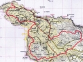
04 - Inishowen Head
 D -
D -Length: 14m Finbarr Mullin, Alan Tees Inishowen, Co Donegal. Map OS 1:50,000 Sheet 3
The Ride
This very hilly route, follows part of the “Inishowen Scenic Loop” on a good track, before it “takes off” on a turf cutter’s track across the bog. The second half of the route is a long climb and descent on a minor tarmac road. Due to its elevation, there are extensive views across the mouth of the Foyle, North Derry and Antrim coasts. Starting and finishing at the “Drunken Duck”.
Time 2-2.5 hours Distance 14Km
Terrain
Hilly route, mainly on tarmaced and non-tarmaced lanes. Bog track can be swampy in one or two places!
Approach
Through Moville, and take the upper road above Greencastle towards Shroove. The Drunken Duck will be on the left. It may not be open as, like many other rural pubs, it struggles with the current draconian drink driving laws.
The Route
From the Drunken Duck ( Sheet 3; Gr C 673 425), follow the road North East for less than a kilometre, turning up hill at Gr C 680 430 (where the main road turns back South downhill to the beach/lighthouse). A substantial climb takes you up to the old wartime lookout post on top of Inishowen head, and the track continues past the picnic area/information board (where St Columba left Ireland for Iona, and climbed the hill for a last look at Derry and the “Auld Sod”), in a North West direction, before turning SW at Gr C 660 452, and going uphill again. The track has been badly damaged here by quads and 4x4s, but is still passable. Ignoring one turn to the right (to an isolated shed) turn right at Gr C 655 446 onto bog tracks over Glenane Hill, keeping left and continuing to a gate/wall. The track continues on the other side to Craig. Out of courtesy, stop and say “thank you” at the first house on the right (The Music House), when you go through the second gate. The lane you just came down is private, and belongs to Mr. Anthony McHendry, a musician and generally hospitable man. A long climb from Craig, leads over Barnes Hill/Crockmore, and descending, take the left fork at Gr C 641 426, turning downhill again at Gr C 649 428, and first left again (at Gr C 650 424), finally descending to Tawnawaddy. Turn left, and just over two kilometres along this elevated road will lead back to the “Drunken Duck”, which hopefully will be open! View Route Edit Route Upload a new photo for this route | |||
21 - Lough Inn
Length: 10m xx
Inishowen, Co.Donegal. Map OS 1:50,000 Sheet 3
The Ride
This is a short route circumnavigating an
upland lake. Starting at the
lake’s west end, it passes the lough on its northern side on a
track, descends towards Lough Foyle, before doubling back, up the hill
on a minor road and taking the eastern shore.
Terrain
Stony track and minor road. Hilly.
Time 1-1.5 hours. Distance 10km
Approach
From Derry follow the main road toward
Moville, turning left at Gr 535337 And following the L.Inn Carndonagh
Road to the far end of the Lough, where the road is joined on the
right by a track Gr 511 394
The Route
Follow the rough track in an easterly
direction along the north side of the lake, and climb over a col,
before descending to join a tarmac road, which continues down hill to
meet the approach road to Lough Inn (from the Derry Moville
Road). Turn right, and climb
gradually over the watershed, pass the lake, and back to the
car.
View Route Edit Route Upload a new photo for this route | |||
22 - Crock of Onions
Length: 20m xx
Inishowen, Co.Donegal Map OS 1:50,000 Sheet 3
The Ride
This explores the high ground of bog and moor
that bounds the Foyle on its western side. Some quiets roads, but much
of it on elevated track and trail with views across Inishowen, and the
river Foyle Basin.
Terrain
Largely quiet roads and ‘forestry quality’
tracks, but after Lough Fada there is a crossing of open bog (about
500m) to link up with a tricky rutted track which descends back to
Gleneely,
Time 2.5 hours, Distance 20
Km
Approach
From Derry to Carndonagh on the R240, then the
R244 to Gleneely Village.
Parking available outside the football club. Refreshments available at The Carraig
Bar or The Orchard Bar.
Route
From Gleneely take the Redcastle Road, pass a
church on the left, and take the next minor road, also on the
left. After about 2 Km, at a
minor crossroads, turn right onto a forestry track Gr 564 423, which
climbs gradually, becoming rougher past the forestry. Where this leads back onto tarmac,
turn left downhill, towards the Foyle for just over a kilometre,
before turning right at Gr 586 396.
This minor road jiggles its way across the
hill with lovely views up the Foyle towards Derry to a T junction at
Gr 572 379. Turn right, up the hill, and follow this track for about
3.5 km across wild bogland until the track is joined by another from
the left, then meets the main road close to the watershed. A short climb leads to the top of the
hill known locally as Crock An Onion (shown as Rowantree Hill on the
map). Just before the viewpoint
carpark, turn left onto another track.
Continue along the top of the hill, ignoring any fly tipping as
best you can, and passing Lough Fada on your left, until the track
runs out. There is about 500m of
open bogland to cross to reach the beginning of the next track, but
this is fairly level, and there are tracks to follow to a badly eroded
area of turf cuttings at Gr 534 410, where the other track
starts. This track is basically
two ruts, divided with moss and rushes, but it is firm, and goes
downhill for about 4 Km, eventually improving after a wire gate, and
arriving back in Gleneely, by either turning right and left, or
continuing straight on to the main road from Carndonagh, then right to
the village.
View Route Edit Route Upload a new photo for this route | |||
05 - Swann's Loop
 VD -
VD -Length: 25m Alan Tees, Finbarr Mullin Inishowen. Co Donegal. Map OS 1:50,000 Sheet 3
The Ride
Combining a fine coastal path, with rough mountain tracks, a bit of “bush wacking”, and a beautiful riverside park, this route has everything, but permission!
Time 3.3-4 hours Distance ?
Terrain
Coastal path, beach, minor roads, unsurfaced mountain track, grassy path. Major ascent is early in the route!
Approach
Through Derry/Londonderry to Buncrana.
The Route
Start in the coastal resort of Buncrana, at the car park (Gr C 343 324) at the Crana Estuary. There is a nice cafe (Fisherman’s Wharf) nearby, on Church St (just above the Lake of Shadows hotel), for refreshments, at the start or end, or both! There are currently no restrictions on cyclists on the Ned’s Point path, but it is very popular with walkers, so show extreme courtesy, and we might keep it that way. There is a “No Cycling” sign at the upper entrance to Swann Park, so if it is busy, avoid it and finish the loop by road, if it is quiet, you might be OK, but dismount where there are other walkers. Park as above, near the old bridge over the river Cranagh at GR C344 326. On the far side of this, turn right of Buncrana Castle, and immediately left of O'Doherty’s Keep, on a good footpath, which soon leads down to the shore of Lough Swilly. Follow the concrete coastal path past Ned’s Point, (a Napoleonic Fortress), and Father Hegarty’s Rock, until you reach the beach at Stragill. Please dismount, or display extreme courtesy to pedestrians on this busy path. Cross the beach to GR 325 348, and at the far side, take the road running inland, and go left at the first crossroads, turning right again at the Loreto Convent junction, (Gr 318 356), turning inland, to a minor cross roads at Gr 324 364. Go straight through, uphill, and turn left at the next T junction (at Linsfort), taking the first right at Gr 326 368, climbing past a standing stone on the left, and crossing the Aghaweel River (unimpressive flow!) climbing to a junction at Gr 334 377. Turn right and almost immediately left, into a lung busting pedal up a track to the wind farm on Drumlough Hill. The climb is worth it, as soon, you are up amongst a forest of whirling windmills, with the distinctive profile of Bulbin (pronounced Bulabagh locally) Hill on your left. Pass the lake on your right, and take the first turn right at Gr 363 399, to circumnavigate, and descend,( delightfully) Beam Hill to another junction at Shandrim Gr 372 380. The views of the Mintiaghs, Slieve Snaght(Monarch of Inishowen) Sl.Main are magnificent from this elevated track, the descent of which is not steep enough to distract the rider from the magic of his/ her surroundings! Descend SW to the main Road R238, but avoid it by using the yellow alternative( the L7011), which becomes a narrow grassy path at Gr 373 365, just short of Drum. This can be heavy going for a kilometre or so, but it improves and rejoins the main R238, which is followed, crossing the River Crana, to Gr 349 328, on the fringes of Buncrana. Turn right,(signposted Dunree) cross a bridge , and consider the possibility of entering Swann Park on the left. There are “No Cycling” signs, but if no one is about!! . And you can always wheel the bike! It is a lovely place, a shame to miss, and will bring you back to the bridge close to the carpark. View Route Edit Route Upload a new photo for this route | |||
06 - North Polar Challenge
 D -
D -Length: 25m Alan Tees Containing an unusually large amount (for Ireland) of non tarmac biking, and great views, this route is a real cracker! In effect it is a largely “off road” circuit of the distinctive Bulbin Hill, visiting remote communities tucked away amongst spectacular mountain scenery. The North Pole Bar is the hub of a very active cycling club based at Drumfries, (evidenced by the many “Cyclists” Signs thereabouts!) If open, stop for a pint, coffee or whatever! Start at the North Pole Bar, Drumfries, on the Buncrana/Carndonagh road (Sheet 3, Gr C 385 390) on Inishowen. Follow to R286 towards Clonmany, past a lake on your RHS, and turn left at Gr 379 412 on the L6881, climbing steadily to a junction at Lough Shivnagh (approx half an hour) on the fringes of the wind farm. Turn right, then left, and cruise pleasantly downhill, by Glasmullan, on a gravel track, to Owenerk. After crossing a river, look for two cottages on your right. In between, is the track you need, at Gr 331 410, not obvious, as you have to go through two farm gates at the side of a cottage, to access it. If the cottage is occupied, it might be courtesy to ask permission (although I understand this is a council road) but in any case, make sure you close all the gates, including a third further up the track. Uphill at first, the track just gets better and better, through this remote glen, finally sweeping down to Effishmore. Metres before hitting the road, double back through what looks like a farmyard, and cross the Ballyhallan River, to meet up with another track coming down from Bulbin at Gr 351 429. Keep left, then first right through Clonmany Glebe (back on tarmac at last) and descend northwards, forking right at Gr 369 444, and first right again at Gr 374 451, then first left through the intricate lanes of Gortnamona. Climb steeply up past some houses, ignore the turn to the right, and continue down to join the yellow road, turning SE then NE to meet the main R258 at Gr 388 448. Turn right, and after a couple of hundred metres, where the main road swings right, keep straight on, up the hill, and around the shores of L.Fad. Meeting the main R244 at Gr 404 424, turn left, and first right, back onto bog tracks. Ignore the first track to the right, and continue to just beyond a fly tipping site (Ugh!), where you will pick up a good track on your right, running SW, straight over the back of Barnanmore (A volcanic Plug), and under Sl Snaght, through a couple of gates, and descending to the car at the North Pole Bar. This route can be linked to the previous one “Swann’s Loop” to make an outing of some 5 hours. 3 hours 25 Kilometres Terrain. Mainly gravel tracks. One substantial climb early in the route (200m approx.) View Route Edit Route Upload a new photo for this route | |||
20 - Inishowen Way (Mountainbike Route)
 D -
D -Length: 80m Alan Tees Route 20 Inishowen Way (Mountainbike Route) This is a cycling version of the Inishowen Way, a conceptual project to walk the Irish coastline from Buncrana to Moville, connecting the two ferries. The walkers route has been restricted, in that the entire Malin area has been left out, due to chronic access problems, and the mountain bike route has been so diverted to avoid contentious areas. Park near the old bridge over the river Cranagh at GR C344 326. On the far side of this, turn right of Buncrana Castle, and immediately left of O'Doherty’s Keep, on a good footpath, which soon leads down to the shore of Lough Swilly. Follow the concrete coastal path past Ned’s Point, (a Napoleonic Fortress), and Father Hegarty’s Rock, until you reach the beach at Stragill. Please dismount, or display extreme courtesy to pedestrians on this busy path. Cross the beach to GR 325 348, and at the far side, take the road running inland, and go left at the first crossroads, turning right again at the Loreto Convent junction, (Gr 318 356), turning inland, to a minor cross roads at Gr 324 364. Go straight through, uphill, and turn left at the next T junction (at Linsfort), taking the second left, just past Ballyannan Br. Follow this very minor road for a kilometre, and take the first right ,(just after crossing a stream) climbing this lane to a T junction at Gr314 390. Turn left and take the scenic tour of Tonduff Hill (interesting megalithic tomb on top). At the next junction turn right, keep left, and descend to Gr 297 395, where a sharp right is taken, descending, crossing the Owenerk River, and following the delightful road, past Milltown and Carha, which traverses the South Eastern slopes of the Urris Hills. Emerging on the Mamore Gap road, turn left, and a steep climb takes you to the top, rewarding views, and an even more rewarding descent on the other side lead down to a car park at Gr 318 443. The hard work really starts here! Follow the newly surfaced track which wends its way unrelentingly uphill to the col between Mamore Hill and Crockmain. It runs out at the top, but there is a fainter trail leading East to the col between Crockmain and Slievekeeragh, which can be mostly cycled as it is either level or downhill, and there are yellow posts to roughly mark the route. Soon you pick up the Butler's Glen track, which exits onto the road at Glen House (food and refreshments). Turn right, and follow the road into Clonmany. From the square, take the road uphill towards Ballyliffin to a cross roads at Gr 380 473. Turn left, towards Annagh, but keep right, and the road takes you down to the beach at Pollan, Gr 387 495. A grassy track along the back of the beach, makes delightful level pedalling for about 2.5 kilometres, with splendid sea views, to meet the end of a track at Carrickabraghy. The road climbs past the old castle of that name, before descending to Lagacurry (the Craft Village there is worth a visit), with good views over the Lagg (Narrows) and the Knockmany Bens on the other side. Turn inland to Claragh, and descend again to the shore at Doaghmore. This scenic little road follows the coastline around the east side of Doagh Island, with a couple of short hills, to rejoin the main (Well, Mainer!) road at GR 422 498, and then the proper main road at GR 407489 (Lackboy). Turn left, and suffer this relatively busy road (there are no feasible alternatives) for about 5k, turning left onto the slab road at Gr 451 468, which leads to Strawbridge on the R238. Go left, and just as you enter Malin Town, turn right past stables at Gr 471 497, on the south side of the Ballyboe River. This becomes unsurfaced before you cross the R243 Malin/Culdaff road, continue past Cracknagh, onto a minor road which leads into Culdaff village over the bridge, and left to McGrorys Hotel (food and refreshments), just past the village green. Departing from McGrorys, turn left and follow the coastal road (a Sli na Slainte) along the river to GR 536 497, past the beach carpark/ childrens’ playpark at GR 547 497. Follow the coastal road past a caravan park, until it turns right, and at this point (GR 553 497) follow the road back uphill, until it joins the Culdaff/ Carrowmena Road. Turn left, and continue along the road for approx 1.5 kilometres, past some mushroom houses on the right, and turn left again, (approx 30 mins from Culdaff) up a lane to Watch Hill (approx 400 metres after emerging on the road) at GR 562 483. The next section is an intricate network of tracks through “claghans”, some abandoned, some still occupied. The laneway twists through some ruined cottages GR 564 485, joining another lane at GR 566 484, where you turn right, then first left, beside a cottage GR 565 483, to another T junction at GR 569 481. Follow this minor tarmaced lane left (north east) towards Bootog to a right angled turn GR 572 483, and then to another T junction at GR 576 478. Turn left, and continue down to another sharp bend at Crockaveela, after which there are more ruined cottages and a further T junction at GR 582 475. This time, go right, then first left (opposite Tremone sign) at GR 580 475, and continue through the hamlet of Ballycharry, to GR 585 469, where the Darcy Magee path is picked up, leading, over a footbridge, and into the picturesque village of Carrowmena, beside the Tremone Bar, GR 591 462. (On this track there is an ancient slab cross at GR 58763 46816). Turn left through the charming unspoiled village, in a northeasterly direction to a junction at Ballymagaraghy, keep right and continue over the hill to a T junction at the Kinnego Bay Road. Cruise downhill with great views of this superb bay opening up ahead, but at the Trinidad Valencera Memorial. you dog leg back uphill and follow this hilly coastal route (one of the tough sections of the Inishowen 100), turning left out to Craig Gr 640 453. A rough track leads over the hill here, but first you must call at the music house ( the one just past the gate) and ask permission of Mr Anthony McHenry. A small gift of cake or biscuits is always appreciated, as is a few minutes chat! Take McHenry's lane over 2 gates and out onto the hill, where turf cutters tracks lead across Glenane Hill to join a more major track at Gr 656 447. Go left, downhill on the Inishowen Head scenic Loop (badly eroded in places by quads and 4x4s) which leads eventually steeply downhill and left to Stroove. 4k along the coastal road leads into Greencastle. From Greencastle there is a lovely coastal path to Moville, but the first section is currently closed, with no immediate prospect of reopening apparently! It can however be accessed a few hundred metres out the oad towards Moville. It is narrow, and popular with walkers, so take care and show courtesy! Map, OS 1.50,000 sheet 3. View Route Edit Route Upload a new photo for this route | |||
07 - Glenveigh
 VD -
VD -Length: 27m Alan Tees, Finbarr Mullin Glenveigh This is a largely off road tour of Glenveigh National Park, which combines some of the finest scenery in the country, with the antiquities of Gartan, and a number of major tourist attractions “en Route”. From Letterkenny, drive to Churchill on the R261, continue through the village, and turn left along the south side of Lough Gartan towards Doochary. After a short distance, turn right down to the Gartan Heritage Centre (also the access road to Gartan Outdoor Centre). Park at the Heritage Centre Gr 061 162. Start by following the estate lane NE along the shores of the lake. Join the R261 again, cross a bridge and keep left, passing the Glebe Gallery, before forking left again and climbing a steep hill to access a minor track along the north shore. This continues in a SW direction for 4-5 Km, past Ardaturr, slightly undulating, but with good views over the lake unfolding on the left. Descend, cross the Bullaba river by a small bridge, and join the R254 at Glendowan, turning right towards Doochary. A gradual climb up this remote tarmac road leads to the high point, and the upper end of Glenveigh, at Gr 971 158, one hour from the start. The castle is signposted at 7km and the visitors centre a further 4! Descend the track to the right into the glen on a narrow stony track, through a gate, and continue delightfully, but with care as the track is rough in parts, towards the lake. On gaining the valley bottom, the track follows the river past an estate cottage to the shores of Lough Veigh, (with the spectacular Asdelleen falls on the left), and continues to the castle (1 hour 45 mins from the start). In addition to the castle, the centrepiece to the Glenveigh National Park, and it’s exotic gardens, there is an excellent cafe (which must not be missed) and toilets. An hour can be spent here very easily! On leaving the castle, continue a further kilometre along the lake, before turning right, (signposted L.Inshagh) uphill, on a gravel track which climbs gradually to a highpoint on Gartan Mountain overlooking that lough. Splendid views unfold over the remote areas of the National Park, and soon you are descending the other side, through 2 gates, towards Gartan Lough. It is worth a short detour to look at St Columbkille’s birthplace and cross. On rejoining the road by the Stag’s heads, turn right past the Glebe Gallery again (also worth a visit to see Derek Hill’s art collection) recross the river Leannan, and gain the lakeside track back to the start. 27k, 3 hours approx. A grand outing! Terrain, mainly estate and forestry tracks, quiet roads, with one descend requiring attention. An alternative would be to start at the Glenveigh Visitors Centre off the R251 Letterkenny/ Bunbeg road, take the track SW towards the castle, but turn left past Lough Inchagh to Gartan and follow the route described above back down Glenveigh, past the castle, to the visitors centre. View Route Edit Route Upload a new photo for this route | |||
32 - Burtonport Line
Length: 75m xx Map OSI 1:50,000 sheets 1 and 2
The Ride This is a linear route, best done west to east due to the prevailing winds and the exposed nature of much of the terrain. It includes wherever possible the old Burtonport Railway Line (still very much a work in progress) with the waymarked ‘Sli na Dhun n Gall/Sli na Rosann/Sli an Earagail’. When complete, this will be the best in the land. The old railway line goes through some spectacular scenery, but old lines otherwise tend to lack a certain interest, being both straight and level. The road sections in this are wonderful, quiet, and add the required interest and variety. Approach. Via Letterkenny, Kilmacrenan, Dunlewy and Annagry on the R259 . Start At the harbour car park Burtonport Gr B71800 15300 Route Section 1 Burtonport to Dunlewy Head south from the Aranmore ferry slipway, along the coast, through the various warehouses connected to the port, crossing a causeway. Cross the road, and you will pick up the ‘Old Railway walk’( signage a red engine) a narrow finely surfaced, level track, well festooned with seating, each in memory of much’ loved and lost’ local folk. This continues delightfully for approx 6 km, only leaving the track on one or two occasions to avoid dwellings built on the old line. It climbs steeply at the finish, to join a road, turn left and continue to follow the red engine signs to a broad cross roads at L.Altercan Gr B 75600 15850, from where the Sli na Rosann takes over. Less than 30 minutes from the port Straight across the cross roads the route follows both yellow walking man and blue’ Route1’ cycle signs, and is well marked on the OSI 1:50,000 sheet 1, running easterly along minor roads towards Annagry. After 5 Km at Gr B 80100 17150 turn left following the walking sign (and parting company with the cycling ones) uphill on a rough cart track, descending past a huge quarry to a T junction. The Sli na Rosann crosses the road, avoiding the fleshpots of Annagry, but I would prefer to turn left into the village, where a break and refreshments can be had en route before rejoining the red dotted line. Turn left at Gr B 80650 19550 ( signposted) and continue along even more minor roads to Crolly, passing a lovely narrow bridge en route. Less than 1 Km south of this bridge, there is a campsite (Sleepy Hollow) and the famous Leo Brennan’s Pub, home of, and launching pad for Clannad and Enya. Turn left, onto the main N56 road, the waymarked route uses the ‘Suloid an Chlochain Bhig’, before rejoining the main road, but I used the main road, it seeming an unnecessary diversion, for about another 3km. Turn right at Gr B 85200 22400, just before a bridge, into the forestry on the SW side of L. Nacung, follow the forestry track for some 6km, finally back onto tarmac, and cross the causeway into Dunlewy. There is a cafe and tourist shop at Inis Cois Locha, on the right, on the far side of the causeway, a grocery shop, a pub and a fine youth hostel in Dunlewy village, and of course Errigal ( which is hard to miss). Distance About 35 Km in all. Time 3-3.5 hours Route Section 2 Dunlewy to Creeslough. Continue with the Sli an Earagail, turning uphill past McGeady’s bar. A steady climb leads over the shoulder of Errigal ( this part will change when this particularly fine section of the railway is renovated) and descent through a pretty glen, following the’ Route 1’ cycle signs for about 8KM to just beyond Lough Agannive. Turn right, uphill, at Gr B 92600 25600 (if you reach the old Cashelnagor station you have gone too far). Soon the scenery becomes even more dramatic. Passing the fish farm below L.Altan, this minor road continues for about 4 km to Gr B 94500 28900, where descent can be made down a ramp, and back onto the old railway line. This is only surfaced (with grit and stones) for 2 km to where it crosses the Falcarragh/ Muckish Gap Road R256 at Gr B 95700 30100. 2-2.5 hours from Dunlewy. Passing a beautifully converted old railway station, continue on a tarmac road over a scenic bridge and rejoin the railway. This continues, gradually uphill, past the N flanks of Muckish mountain, and delightfully along the shores of L. Agher. Stony in places, and passing through at least 2 cuttings, it descends to meet the access road to the N face of Muckish( about 6 km from the Falcarragh Road, and a leisurely half hour’s cycle). Across the road, the railway embankment is irresistible, but alas it doesn’t go far, and at the time of writing it was unsurfaced, though easily bikeable. A kilometre of bumpy grass and mud and you are obliged to descend back to the road, the line ahead being otherwise occupied with forestry and private dwellings. Rejoin the road at a stile, and turn right. Descend past the quarry, Noreen Bawn’s Cottage (worth a detour) before turning right (signposted) at Derryharriff Glebe Gr B 04100 32200. Ignore the left fork (at a rock with a horse on it), and continue to a T junction, turn left, and descend into Creeslough, where there is a cafe, sadly uphill to the right! Distance 40Km approx Time 3.5-4 Hours View Route Edit Route Upload a new photo for this route | |||
08 - The Corgaries
Length: 40m A.Tees, 27th Nov 1990 Route 8, The Corgaries This route wends its way through the wild border area South of Barnesmore Gap, surely the biggest wilderness area in the North West. Heavily forested, the remoteness of this area was exacerbated by the fact that cross border access roads were cratered by the army during the troubles, and the few habitations passed are usually derelict. Start, at the legendary Biddy o Barnes ( an old wayside public house where the fire reputedly never went out during the occupancy of the innkeeper Biddy) Gr G019 845, at the Western end of Barnesmore Gap. Cycle back up through the Gap towards Ballybofey, but as you turn right at gr 052 885 towards Castlederg on the old unapproved road (about 20 mins), you quickly swop the snarling traffic for solitude. Continue down this narrow tarmaced road for about 6 Km, just past Sruhangarve Bridge to where signs for KIlleter Forest appear, and turn right at Gr 109 871 up into a forestry track and the Sixth Corgary. After a short distance there is a crossroads (not marked on my map) but keep left at this and continue through the forest, climbing gradually. Ar Gr 097 844 the main track seems to swing left (also not marked on my map) but keep on straight up the hill, before descending the other side of Cross Hill to regain tarmac at a T junction beside the river Gr 089 818. Turn left (there used to be a campsite here) and after a short distance turn right at Big Bridge. A tarmac road leads west, rounding a small lake (loughahull) and Derg Lodge (in ruins) before descending slightly to Kelly’s Bridge, another remote border crossing, the bridge reinstated since the troubles (Just over 2 hours from the start). Coillte forestry takes over on the far shore. The first turn left will lead down to Lough Derg for those who require more exercise or some spiritual renewal/religious penance, but our route continues up the hill and then westwards along the flank of the hill to fork right at gr 033 781 at Meenadreen onto another cart track. Soon this begins a long rough potholed descent past the scenis L Cuill to join the minor road linking the west end of Barnesmore Gap to the village of Laghey. Turn right at Gr 981 775, and follow this road for approx 6 Km until it joins the old Barnesmore Gap Donegal Town Road. This gives a quieter alternative to the new trunk road for a while, but the main road has to be joined for the last kilometre or so back to Biddy’s. 4 hours, 40 km, mainly deserted forestry tracks and minor roads. Maps, OS of NI Sheet 12 (Strabane) 1;50,000 (Part of route), and Discovery Sheet 11 1:50,000 ( all of route, but less detail). View Route Edit Route Upload a new photo for this route | |||
09 - An Port
 D -
D -Length: 20m Not known An Port/Glen Head This is a popular route, combining part of the most spectacular sea coast in Ireland, with the special atmosphere of this most remote area of the Gaeltacht, and numerous antiquities. Approach through Ardara or Carrick to Glencolmcille, Gr 530 847. Follow the road out of the village East for 2k to a fork at Gr 552 850, where the left branch is taken, alongside the Murlin River to another fork, at Gr 588 866 (near PO). Leave the road here on a track North, crossing the river, and following the track for 2.5 k to rejoin a minor road at Lougheraherk. Turn left, and take this (now tarmaced) road down the glen towards the distant bay. Four kilometres ahead, An Port, once considered by Lonely Planet as the most remote place in Ireland, now has a carpark, and is rarely deserted at weekends or during the summer. It is worth leaving the bike here, and walking up Port Hill to view the spectacular sea stacks of Toralaydan, and Tormore, and the inaccessible Glenlough Bay beyond. Back at An Port, cross the bridge and follow the grassy track, climbing gradually to Garveross Hill, descending in a SW direction to Gr 536 863, where a right turn, and climb, has to be made, to gain the more coastal descent track from the signal tower down to Biofan and Glencolmcille. 20k, 2.5-3 hours. Minor Roads and grassy tracks. OS 1:50,000 sheet 10 View Route Edit Route Upload a new photo for this route | |||
10 - Around Inch
 D
D Length: 32m Geoff Thomas, Alan Tees This is an attractive route on minor trails and roads, no more than 20 minutes from Derry, taking in the island, via 3 embankments, and a nature reserve via an old railway line. Start at Kernan's cafe on the main Derry/Letterkenny Road N13 at Newtowncunningham Gr 311 167, and continue out towards Letterkenny to the end of the village, turning right at grid 304 167. Take the first right turn, approx 1k along this road, and continue to the end of the road to the Blanket Nook railway embankment, which is crossed on a narrow grassy track, going rightwards under an old bridge at the far end. Turning uphill, there is an old graveyard on the right (worth a visit) and beyond this, keep left and left again, to round Finwell Hill on its North side. Continue downhill to the junction at Gr327 206, turn left through Carrowen to the newly renovated Farland Bank amenity area/carpark. A good gravel track across this, leads to Inch Island, but it's not actually joined up to anything on the far side! A narrow path through brambles leads rightwards to wet ground on the lakeside. This is heavy cycling, or hopping between dryer patches, (made worse in wet weather by cattle), but there are no obstacles between Farland Bank and a new car park on the lake side, from which the road can be accessed at Gr 345 232. ( It may be easier to climb directly up the field at the end of the bank to the road). Turn left, and begin a clockwise circumnavigation of the Island. The road climbs past Inch Castle, and descends to the scenic Mill bay. Continue around the coast to the road end at Binalt.There used to be a track connecting Binalt to Inch Fort,(still marked on some maps) but this is now sadly overgrown. A circuit of Inch can still be made by crossing a couple of fields just below it, and to do this, go up a lane just before the road end, which turns and runs parallel to the coast. At a gate, go into a field (you will see the overgrown track above on your right), cross the field and another to gain a track at the far end, which leads to a minor road and thence to the road just above the pier.Turn right, and take the coastal road to the causeway, cross this and keep right at the other side, towards Burnfoot. At Gr 361 235 a new footbridge can be seen on the right through a gateway. When this bridge is crossed, there is a wonderful footpath (renovated railway embankment with bird watching hides) leading all the way back to the Farland Bank. Show extreme courtesy to pedestrians, as this is heavily used! Retrace your route through Carrowen, keeping right at the first fork, through the crossroads, and turn sharply right at Gr328198, towards the prominent Burt Castle on the hill. The route circles the hill to the North and West, before taking off SW, on a couple of 'dog legs' to join the main Derry Letterkenny road(N13) just East of Kernans Filling Station/Cafe. 3.5 hours, 32k, minor roads and good tracks. One section, of less than one kilometre, of boggy wet ground(should be dryer in summer). View Route Edit Route Upload a new photo for this route | |||
15 - Tour De Bluestacks
 D -
D -Length: 80m Kevin Deery, Alan Tees 1992 Route 15, Tour De Bluestacks A bit of a block buster, done in 1992, starting and finishing in Biddy O Barnes. As Barnesmore Gap just gets busier and busier,( and the landowner forbids use of the old railway track) it is recommended to leave a car at the old school Gr 095 920 at Blackburn Bridge, about 2 kilometres East of Lough Mourne, as you approach from Ballybofey. Start at Biddy O Barnes Gr 020 845 on the West side of Barnesmore Gap, exit onto the main road towards Donegal Town, and take a minor road running almost parallel on the North side of the main road at gr 012 839. Follow this until it joins the Lough Eske loop road, turn right, and keep on this (anti clockwise) around the North side of the Lough until about 10 o'clock! Turn right at gr 959 848, past a small B&B and up, on a forestry track, over the North col of Banagher Hill. Cruise down the valley alongside the Eglish River, and at the T junction, turn right crossing the river, and about 2k further on, after crossing the Sruell River, bear right towards the mountains. Another 1.2 k at gr 908968, turn left onto trackks, first NW then SW, which take you back onto the road again at gr 884 860. Turn right, and take the first left, West, then South on a track onto a minor road which joins the main road (R262) at Gr 845 826. Turn right along this road for approx 6k to Sir Albert's Bridge, where you turn right and continue 2.5k to where the road forks at a bridge. Keep left, and follow signs for the 'Bluestack Way'. A long straight narrow grassy track crosses the bog (A famine road) north Westerly. Take this, and follow it down the hill, crossing a footbridge to join the R253 Glenties/Ballybofey road. Turn right along this road for 6.5k, and 1k beyond McKevitt's Bridge, turn right alongside the Owengarve River. This becomes a track and climbs over the col at Croaghubbrid following the Reelan River downhill, until just beyond a ruined school, turn right at Gr 961 942. This goes downhill towards a farm at Crolack (known in some quarters as 'Coronation Cottage'), cross the river and follow the Bluestack Way signage in a SE direction. It may be necessary to carry the bike along sections of this wet hillside! Traversing above the forestry, the track is regained over Polldoo, on the S side of Gaugin Mt, and followed to a bridge at Ballykergan. Turn right here gr 018 948, and climb to a minor crossroads at Prieststown Gr 032 966, turn right and ascend past Altnapaste and Garranbane Hill. Hereabouts, the road becomes a forestry track, and doubles back in a Northerly direction. After about 3k turn right at gr 072 939, go left at a T junction, then first right, and finally keep straight ahead to emerge at Blackburn Bridge on the N15, where hopefully you have left your car! If not, turn right and endure the traffic back to Biddy's through the Gap. 80k, OS 1;50,000 sheet 11 View Route Edit Route Upload a new photo for this route | |||
30 - Kerrykeel Loop
Length: 16m xx
Fanad Peninsula, Co Donegal OS 1:50,000 Sheet
2
The Ride
Starting from the picturesque Village of
Kerrykeel on the shores of Mulroy Bay, this attractive route makes its
way up through the spinal hills of Crockanaffrin on the Fanad
Peninsula on a miriad of minor roads and tracks, visiting remote
hidden valleys and lakes, before returning to Kerrykeel, where there
are both charming coffee shops and attractive pubs.
Terrain
Minor roads and farm tracks, with one short
rough and stony descent.
Time 2.5 hours. Distance 16
kilometres
Approach
Through Letterkenny, Milford to Kerrykeel on
the R246.
The Route
Park on Kerrykeel Main St, and follow the R247
towards Rathmullan for about a kilometre, before turning right, just
before a church at Gr 219 324.
After another kilometre turn left, up a steep hill at Gr 220
313, bearing right as the road becomes unpaved. Ignoring any left turns, continue with this through a
couple of gates (private land, please close the gates signs) and a
variety of surfaces, climbing over the hill just west of the summit of
Crockanaffrin. On descent, it
becomes rougher and more challenging, before meeting another gate at
Gr 239 287. Back on tarmac,
descend south to a staggered crossroads at Gr 240 274 (another church)
left and then right , to continue south, then west at Gr 235 258, (as
you join the road linking Ray with Milford). Climb gradually, and then descend, but after 2.5
kilometres, (on the downhill), turn right onto a track at Gr 210 260.
Initially a forestry track, it is bounded on the left by Lough
Colmcille, and continues for almost 2.5 k until regaining tarmac at a
T junction, where a right turn is taken uphill. At the next T junction Gr 217 294, turn left onto the
Dean’s Road, pass a little lochan, and continue to rejoin the
R247. Then turn left, back down
the hill and into Kerrykeel.
View Route Edit Route Upload a new photo for this route | |||
31 - Mulroy Loop
Length: 20m xx Fanad, Co. Donegal. Map OS 1:50,000 sheet 2 The Ride Whilst the remoteness of this ‘off shoot’ of the Fanad Peninsula is somewhat lessened by the construction of the Blaney Bridge, it is still not often visited, with traffic rarely encountered in its myriad of twisting minor road and lanes. Terrain, Virtually always surfaced in some fashion, but with many of the lanes having a grass ‘Mohawk’ up the middle. Lots of short hills, some of which are steep. Time 2 Hours. Distance 20 km; Ascent 250m. Approach From Letterkenny to Ramelton, and Milford on the R245. Continue on the R246 through Kerrykeel to a crossroads at Portsalon, but keep straight on towardsFanad Head. At Kinnalough Gr C 204 453, turn left along the coast for 3 km, and park at Rinboy car park. Route From Rinboy, continue West for a kilometre to Ballyhoorisky, and turn right at Gr C 160 443, following a lane which loops around the coast. About 1.5 km ahead turn right onto another lane at Gr C 161 430, which zig zags its way through some hilly terrain with small loughs and secluded homesteads, to join a yellow road at Tulaigh. Turn right, and take this road west towards Mulroy Bay, and then south to the remarkable, and almost landlocked Tully Bay (and even more remarkable bridge, seemingly in the middle of nowhere!). Skirting its northern shore, continue through the crossroads to the chapel and school at Gr C 174 388, and go left. After about 2 km, the road climbs left over the shoulder of Lurgacloughan Hill to join another similarly minor thoroughfare. Keep right, then immediately right again at a T junction, to the fork at Tullynadall. Keep left, and turn left at Gr C 178 426, keeping immediately right along the west side of L. Kindrum, for about 2 Km, before rejoining the coast road, turning left and back to the car one kilometre away. View Route Edit Route Upload a new photo for this route | |||
16 - Bunlin Mountainy Way
 D -
D -Length: 28m Geoff Thomas, Alan Tees 2013 Route 16, Bunlin Mountainy Way The Lough Salt massif is crisscrossed by a net work of rough tracks which wend their between scenic lakes, and less scenic turf banks. This route makes a loop of the two continuous trails crossing the range from Glen Village to Bunlin Bridge, and back. It starts and finishes on the waymarked 'Bunlin Cycle Way' Start in Glen Village, gr 120 310, turn uphill (east) past the Old Glen Bar, and follow the road, (and the blue cycle signs), climbing gradually for a kilometre or so before it levels off, then turning right onto a lesser road at Gr 140 307, forsaking the Bunlin Way, for a more mountainy route! Turn left onto a track after 200m (first turn) and rattle along the gravel past Lough Natooey, until the track turns into a grassy borreen. It gradually ascends, levels off, and descends to join a good track at Gr 154 294. Turn right, uphill, through a narrow valley to the bottom of L. Nacreaght, now used as a reservoir. The track now climbs delightfully over the watershed, across the top of the ridge, and down the other side, becoming tarmac, as the first habitation is reached. The views down over Mulroy Bay are superb. Keep left, then right at the T junction as you rejoin the Bunlin Way, and descend to the R245, which runs alongside Mulroy Bay. Follow this right, SE, past Bunlin Bridge, climbing through Golandoo, turning right at Gr 162 262, about 2k past Bunlin Bridge. Sadly its uphill again for a kilometre, but when the road doglegs left, you continue up the hill on a series of zig zags up a forestry track. This is rough, stony, and fairly tough, but the incline eases and you reach L.Donnell. Bear right, descend, and keep right as you climb the next hill, through a gap, and soon you are descending the east side of Pt 343, with fine views of L.Nacreaght on your right. The track contours, turning west, descending to meet a minor rd at Gr 138 297. There is a staggered crossroads here, go left, then right, onto a lovely wild track through deserted cottages, leading down to the main Lough Salt road. Turn right, freewheel down into Glen Village, and sample the delights of the quaint and very popular Old Glen Bar! 28k, 3.5 hours, Map OS 1;50,000, sheet 2 Terrain, mainly gravel/stony tracks, one short grassy/rushy section of boreen. View Route Edit Route Upload a new photo for this route | |||
25 - The Appalachian Trail, Ulster Chapter.
Length: 333m xx Counties Donegal, Tyrone, and Derry, The Ride Established in 2011, this continues the famous USA east coast trail across the province of Ulster from Sl. League in the west, to Larne in the east, where it crosses to Scotland. This is a walking trail, much of it ‘piggy backing’ on existing waymarked routes such as the Bluestack Way, Ulster Way, Sperrins Scenic Route, and some of it is unsuitable for biking, so the closest alternative route is provided, and indeed quite a bit of the route is already covered in routes described in the guide. As this guide is only for the North West area, our route description will cease at the river Bann, just short of Coleraine, but details of the attractive Antrim Coast sections can be found on the Internet under www.walkni.com As this is very long route, only brief details are provided, and the sections are largely based on the walkni model. Section 1. Bunglas to Glenties. Map OS 1:50,000; Sheet 10 &11. Start at Bunglas Gr G 571 755 the famous viewpoint over the Slieve League cliffs, descend and turn left into Carrick. Take the Glencolmcille Road, but fork left past L. Auva to Malinmore, and turn right into Glencolmcille. North of the village, a track climbs steeply over Glen Head and down into An Port (see route 13, which covers this route in reverse). Follow a track and then a minor road east around Crockuna Hill and descend Granny’s Glen ( see route 12) continuing along the south shore of Loughros Beg Bay and into Ardara. The N56 leads on to Glenties ( hostels and hotel). 70Km. Section 2. Glenties to Killeter Map OS 1:50,000 Sheet 11 & 12 Follow the R253 ( Reelin Bridge Road) and turn right across the Owenea River at Gr 826 933 onto a track. This climbs, then levels out, rejoining a minor road at Tullynadoobin after just over 3 Km of narrow path. Follow this road south west to join the R262. Leave this left at Gr 845 825, and utilise a network of minor roads (see Tour De Bluestacks route) to cross the col between Banagher Hill and the main Bluestack Range, and descend to Lough Eske. Turn right, cross the main Ballybofey to Donegal Town road, and follow minor roads and tracks to Kellys Bridge, and the border (see Route 11 the Corgaries). At Big Bridge Gr 092 816, leave the Corgaries Loop, and keep right (eastwards) on minor roads into Killeter. 55km. Section 3. Killeter to Gortin OS 1:50,000 Sheet 12 Leave Killeter in a south easterly direction, rounding the Hill, before continuing north east into Killen Village. The route then follows minor scenic roads east, crossing the B50 (Castlederg to Drumquin road), and continuing north east to Baronscourt forest, either rounding Bessy Bell on its south flank, or over the top, by a wind farm track, to the Strule river. This is crossed at a bridge, and the route continues to the west end of the extensive Gortin Glen Forest Park. There would be a number of options through the park, but the route crosses the Omagh to Gortin road near the main car park entrance to tracks on the left hand side of the road, before recrossing just over the watershed, turning right, and following signs to the scenic lakes ( see route 18). After passing the lakes, the route dog-legs back, and descends to a T junction. Turn left into Gortin Village. 58 km
Section 4. Gortin to Dungiven. OSNI 1:50,000 sheets 8 , 13 and 7 (or Sperrin Activity Map) Leave Gortin towards Plumbridge, and just after the bridge, take the first right and immediately left, uphill, to join a high road traversing the south flank of Craignamaddy hill, east to Barnes Gap ( see route 19). Through the gap, keep right and follow a belvedere, Corramore Road , overlooking the Glenelly Valley, dropping into Sperrin Village after about 9 km. Climb over a broad col by Goles Forest , descend, and take the first left around Crockbrack, and turn left into Moneyneaney. 37km The walkers trail to Dungiven goes over Mullaghmore into Glenshane Forest, then tracks the main Derry to Belfast road, the last bit on the busy A6. The open hillside of Mullaghmore would be heavy going on a bike, so I would much prefer to use the much more direct, and scenic, Banagher Forest to approach Dungiven. On leaving Moneyneaney, stay on the B40 Feeney road over the hill, leaving it on the right at Gr 702 007, into the forest, and following forestry tracks along the banks of the Glenedra stream down to the Banagher Glen Nature Reserve car park ( see Route 14 ‘Beats Banagher’). From there, a quiet road leads north east into Dungiven. 53 Km. Section 5. Dungiven to Castlerock. OSNI 1:50,000 Sheets 7, 8 and 4 Whilst the walkers trail utilises the track up Ben Bradagh and open country down into Gortnamoyagh Forest, this seems unnecessarily hard work, and perhaps it is better to follow the North Sperrins Scenic Route (or B64) north east to Legavannon Pot, taking the next left at a 5 road junction and bypassing on the west Donald’s Hill and Cam Forest, before joining the B66 Limavady to Aghadowey Road. Turn right and after 2 km, left, into Springwell forest where a forestry track leads across to the main Limavady to Coleraine Road ,A37. This is very busy, but with a good hard shoulder, go right and take the next forestry road (windmills) to the left, which leads across to what is known locally as the Murder Hole Road. Be not intimidated, and turn left to Gr C 726 277, turn right and climb along the edge of the forestry until close to the mast on top of Harkins Hill where you will get back on tarmac. A couple of dog legs later, you are cruising along Bishops road on the escarpment with great coastal views to the left, to Downhill. A short climb out of Downhill will bring you to the entrance to the Mussenden Temple and the Bishops Palace gardens. There is a path into Castlerock from here, or you can follow the main road into this attractive resort at the mouth of the river Bann. 60km. The next sections, which follow the stunning north Antrim Coast, starts on the other side of the river and is outside the area of this guide. For Details see www.walkni.com.
View Route Edit Route Upload a new photo for this route | |||
31 - Mulroy Loop
Length: 20m xx Fanad, Co. Donegal. Map OS 1:50,000 sheet 2 The Ride Whilst the remoteness of this ‘off shoot’ of the Fanad Peninsula is somewhat lessened by the construction of the Blaney Bridge, it is still not often visited, with traffic rarely encountered in its myriad of twisting minor road and lanes. Terrain, Virtually always surfaced in some fashion, but with many of the lanes having a grass ‘Mohawk’ up the middle. Lots of short hills, some of which are steep. Time 2 Hours. Distance 20 km; Ascent 250m. Approach From Letterkenny to Ramelton, and Milford on the R245. Continue on the R246 through Kerrykeel to a crossroads at Portsalon, but keep straight on towardsFanad Head. At Kinnalough Gr C 204 453, turn left along the coast for 3 km, and park at Rinboy car park. Route From Rinboy, continue West for a kilometre to Ballyhoorisky, and turn right at Gr C 160 443, following a lane which loops around the coast. About 1.5 km ahead turn right onto another lane at Gr C 161 430, which zig zags its way through some hilly terrain with small loughs and secluded homesteads, to join a yellow road at Tulaigh. Turn right, and take this road west towards Mulroy Bay, and then south to the remarkable, and almost landlocked Tully Bay (and even more remarkable bridge, seemingly in the middle of nowhere!). Skirting its northern shore, continue through the crossroads to the chapel and school at Gr C 174 388, and go left. After about 2 km, the road climbs left over the shoulder of Lurgacloughan Hill to join another similarly minor thoroughfare. Keep right, then immediately right again at a T junction, to the fork at Tullynadall. Keep left, and turn left at Gr C 178 426, keeping immediately right along the west side of L. Kindrum, for about 2 Km, before rejoining the coast road, turning left and back to the car one kilometre away. View Route Edit Route Upload a new photo for this route | |||
|
County Derry/Londonderry Without the same level of wild terrain as Donegal, this county still shares the Sperrin Mountains with Tyrone, and has a substantial coastline, if you include Lough Foyle. There are 20 forest parks, (the one I would be most familiar with being Loughermore, an extensive forested hill between Limavady and Claudy), but many others see a lot of bikers such as Cam, Ballycarton, Garvagh, and Ballykelly Add route description here... |
|||
|
Edit note
Upload a new photo for this note |
|||
11 - Binevenagh
 E1 -
E1 -No length recorded not known Route 11, Binevenagh. Binevenagh and Ballycarton Wood are one of the few places you are likely to meet other bikers, and the woods are riddled with little tracks, jumps etc. The woods cover the lower slopes of the mountain, and this route wends its way through them to the mountain top. From the cliff top there are most impressive views, and the descent is challenging for those who choose to stay in the saddle! Start. From Limavady take the A2 road towards Downhill, for about 6 km to reach Ballycarton Wood. There is parking in a yard up the entrance to the wood at Gr 677 294. Follow a lateral track (gate 4) signposted with red 'Binevenagh Forest Cycle Route' arrows, running parallel with the main road to a 'T' junction. Turn right up the hill, climbing some zig-zags, (and following the arrows) before the forest track levels off, contouring northwards below the mountain. After a further steepish climb, the track takes the lower edge of the forest, and views open up to the left over Lough Foyle and Inishowen. Just beyond, at a blue totem pole, the track joins a tarmac road, (30-40mins from the start). Turn left, uphill, climbing until a forestry gate is reached on the right. Turn right, back onto a track which ascends gradually to reach the lake at the top of Binevenagh (approx 1 hour from the start). At the track end, continue along a grassy path to a 'Warning Steep Cliff' Sign. Those without suicidal tendencies should bear right, and take the delightful, airy, clifftop path, taking care in some places. Soon it plunges down an eroded slope, over logs, roots etc. Bike all of it if you can, or dare, some of it, or portage down to join a forestry track at Gr 697 318. Turn left, traversing along the track, to reach a gate adjoining open land, with a sign prohibiting cycling on paths beyond, so take the descending eroded bike track just before the gates to reach the track you came up on. Left again, and retrace your steps (or tracks rather). This time, as it is downhill, you will be able more easily to enjoy the various biking diversions, some with jumps, on the left and right. At the crest of a small bump, a well beaten path crosses the track, ( Gr 680 309) turn right and descend a path down to the delightful St Aidans Church and Holy Well. Back on tarmac at last, cruise downhill ( probably with muck spraying from the tyres), turn left, and left again at the main road,( towards Limavady). The last bit, along the edge of Ballycarton wood, can be done on a track parallel with the road, by turning in at the first gate. 2-2.5 hours, Map NI OS Sheet 4, 1;50,000 View Route Edit Route Upload a new photo for this route | |||
17 - Loughermore Summit
 D -
D -Length: 14m Not known Route 17 Loughermore. This is an elevated forestry area behind the village of Eglinton, but most easily reached via the B69, Limavady to Claudy Road. As most of the trail is within a forest, the views are limited, and the surface somewhat monotonous, but it gives a convenient workout for anyone living in the Derry/Limavady area. Park at the small 'Loughermore Forest' (signposted) carpark beside the bridge at gr 584 126 just off the B69. Follow the track beside the stream, which bends right and becomes a narrow grassy path to join the Slaghtmanus Road. Turn left, then right at the crossroads onto the Brockagh Road, then first right again onto the Myrtle Road (well signposted) towards Greysteel. Continue straight up the hill, past two modern houses on your left, until the road finishes at a forestry gate. Now you are on forestry tracks. Take the first left Gr 572 143, and first right (beside a waterfall/pool) and begin the long climb up to Legavannon. Actually, it's not too bad, and just after it levels off, bends right, and goes downhill, take a sharp turn, uphill, to the left. After the first steepish bit, it eases, turns left and continues to Loughermore summit 396m, with a trig point, and good views on a fine day. Retrace your route, and take the first turn left, which gives a great long looping descent to the bottom of the hill. Where the track forks, keep left, descending further, over a ditch onto the road. (If you keep right, a further ascent will bring you back eventually to Myrtle Rd). Turn right on this minor road, and it soon joins the B69, taking you back to the carpark at Loughermore Bridge. 1 hour 15 mins approx (you can spend as long as you want exploring the many tracks in the forest) Distance, 14k Terrain, minor roads mainly, and forestry tracks. Map, 1;50,000 Sheet 7, Londonderry. View Route Edit Route Upload a new photo for this route | |||
26 - Maiden City Tour
Length: 8m xx
Derry/Londonderry. Map OSNI 1:50,000 Sheet 7 (Better to get a city map
from the Tourist office)
The Ride
The Maiden city is a convenient ‘cop out’
avoiding the Derry v Londonderry v Doire mantrap, but it could be more
aptly called the Phoenix City nowadays, having risen magnificently
from the ashes of the troubles.
Two of the main factors in its wondrous recovery were regarded
with some cynicism by many, including myself, but the construction of
the Peace Bridge and the 2013 UK City of Culture, boosted the pride
and elevated the self belief of the citizens to an entirely new
level. The river front has been
developed with cafes, perfect for a promenade, and a greenway links
the now much more accessible St Columb’s Park with the Foyle
Bridge. This route links these
two features via the Peace and Foyle Bridges, and throws in a couple
of extras!
Terrain. Custom built cycle track. Some steps if the City walls are
included
Time 1- 1.5 hours. Distance ??
Approach
A good place to park, and start, is the Foyle
Arena leisure centre car park in St Columbs Park. This is on the
Limavady Road. Coming into the city from Belfast, follow the signs to
Coleraine/Limavady, turning left
at the roundabout just before the Foyle Bridge. This is initially dual carriageway, but narrows at
the 30 mile a hour limits. The
Arena is on the right a couple of minutes beyond.
The Route
Leaving the car park, follow the stream-side
path through St Columb’s Park downhill to a children’s play area,
from where the greenway can be accessed, running north beside the
railway line.
This level track, much used by dog walkers and
pram pushers, leads eventually to the approaches to the Foyle
Bridge. Turn left, initially
along the footpath and then climbing gradually up a protected pathway,
with traffic roaring and snarling on your right, to the high point of
the bridge. Freewheel down the
other side and enter the first layby on the left, from which a track
descends beside the bridge to the Bay Road park below.
A number of alternative tarmac tracks lead
back through the park towards the city, past Da Vincis Hotel. Just beyond a busy roundabout, turn
left on a footpath to access the riverside walk and promenade, which
leads delightfully past several coffee shops by the marina to the
Peace Bridge.
(Visitors to the city might wish to
circumnavigate the historic walls either by foot or by bike. In which case, cross the main
carriageway at the Guildhall, and be careful with the steps and
courteous with the many tourists you will meet there on most
days). Otherwise, cross the Peace Bridge, through the
Ebrington Centre (lunch or more coffee here), keep left through the
security gate, crossing a quiet road into St Columb’s Park again,
and make your way back to your transport.
Should you wish a further diversion, ignore
the Peace Bridge and continue along the promenade to the double decker
Craigavon Bridge. On the other
side of this, the old railway has been made into a foot and cycle
path, running for some miles along the river. Due to an access problem it cannot continue directly
into the Donegal village of Carrigans, but climbs uphill and out onto
the road. Return can be made either along the road or back along the
track.
View Route Edit Route Upload a new photo for this route | |||
26 - Slieve Galleon Braes
Length: 12m xx Map OSNI 1:50,000, Sheet 13 The Ride Best known perhaps as the object of a popular traditional song, Slieve Galleon is an outlier of the Sperrin Range, and its central location in the six counties of Ulster makes it an outstanding viewpoint. Like many places of prominence nowadays the summit is capped by a communications mast, but the good news here is that it is accessed by a good tarmac road at a reasonable angle (the bad news is that cars can also get right up to within a kilometre of the mast). Once the plateau is reached, other rough tracks offer themselves, some of which will give a challenging enough descent. 1.5 hours. 12 Km. Height gain 350m Approach From Cookstown to Moneymore, turning left at Ratheane, just beyond the village at Gr??Follow this road for about 6 Km to a cross roads at Gr 83700 87200 (171m). Turn left and park at a gateway in Carndaisy Wood, less than a kilometre away. The Route Ride back to the crossroads and turn left, beginning the long climb towards the summit. As you ascend, extensive views open up of fertile rural mid Ulster with its patch work of fields, nearby Lough Neagh, and further afield, Slemish in Antrim, and the Mourne Mountains in Co Down. Some way up there is a picnic area and viewpoint, bearing the litter scars of easy motorised access. On reaching the plateau, the track levels out somewhat, then climbs slightly to reach a locked gate (and the end of the road for the infernal combustion engine!) Not far beyond is the highpoint and the mast. After taking in the view, retrace your steps to gr 81200 88600 and leave the road right at a bend onto a rough landrover track ( about 1 hour to here). Follow this for a short distance and take the first left which is followed along first a stony cart track, then a grassy descent to rejoin tarmac at Tintagh. Zoom downhill to the first crossroads (at Fairview house where there is a windmill) turn left and regain your transport after about 2 Km. An attractive alternative would have been to continue over Tintagh Mountain 528m, using one of the descent tracks on that side to reach the attractive Lough Fea, returning along the Southern flanks of Slieve Galleon. Alas, the fine track circumnavigating the shores of the lake is closed to cyclists, so there is currently little point.
View Route Edit Route Upload a new photo for this route | |||
33 - Beats Banagher
Length: 20m xx Co. Derry/Londonderry. Map OSNI Sheet 7 & 8, or Sperrins Activity Map 1:25,000 The Ride This is a popular route, almost entirely off road, taking in the beautiful Altnaheglish Glen, Banagher reservoir, with a lovely non technical descent to finish. Terrific, the gem of the Sperrins for those not looking for anything too challenging! Terrain, initially tarmac, then good forestry tracks. One short optional technical climb and descent. Time 1.75-2 hours. Distance 20km
Approach From Dungiven, take the Feeney road, and follow the signage left to Banagher, parking at Gr ........ There is space for 3 or 4 cars here. Route Beyond the gate, a private water service road leads delightfully alongside a stream for about a mile to the bottom of Banagher Glen. Continue past the old waterworks buildings, carparks etc following the signage to the dam. Climbing gradually on tarmac, with the river initially on your left, and after about 20 minutes you reach the dam. Just beyond, the gravel track descends and runs along the lakeside, through a gate, above the serpentine shores of the stunningly beautiful Banagher reservoir. At the far end of the lake, turn right at Gr 709 027, following the stony track downhill, across a stream, and right, climbing gradually for just under a kilometre, turning left at Gr 703 030. Continue to climb, then left along the forest edge over the top of Altnaheglish hill, descending to a T junction. Turn left and follow the track down to a concrete bridge, marked 'Ford' on the map Gr 699 013. After crossing the Crooked Burn, turn right and follow the track in a NW direction, recrossing the stream, to a junction at Gr 676 034. Ignore the right turn, and continue straight, on a more minor track, through a gate with a 'road closed' sign on it. This continues gradually, and delightfully through mature woodland, downhill on a narrowing path, to another gate. Either continue straight on (ignoring another right turn) or take a steep narrow path uphill on the left, just beyond the gate (more challenging); both of which will lead back to the car parks at the bottom of the glen. Return to the car by the water service road.
View Route Edit Route Upload a new photo for this route | |||
|
Tyrone Tyrone is said to be “Among the Bushes”. This it may be, but it has the lion’s share of the Sperrins, and no less that 30 forestry sites. Gortin Glens is undoubtedly the best known, with a scenic drive, many walking paths, and a number of custom made mountain bike trails. Tyrone has also 2 other dedicated forestry sites at Davagh, near Cookstown and Blessingbourne, just outside Fivemiletown. Davagh. OSNI Map 13; Start Gr H694 862; Postal code BT79 8JH. Davagh has a 3k green route, a 7.5 blue and a 16k red route. For further details see www.mountainbikeni.com Blessingbourne. OSNI Map18; Start Gr 448488. This has a 4k blue and an 8k red, with a café, bike hire, showers, car park (fee). For further details see www.mountainbikeni.com. Add route description here... |
|||
|
Edit note
Upload a new photo for this note |
|||
|
Fermanagh Said to be more in Lough Erne that out of it, many promising lanes end up at a jetty. Nevertheless, this is Ireland’s beautiful Lakeland, and again has many forestry sites, 28 in all, the most visited probably being Castlearchdale . This is a popular area for visitors, and there is something there for everyone. Many tracks are allocated for many different users, and the signage can be confusing with three different cycling signs alone, a green one, a blue one and a Route 91. To add to it all, the only cycle route on the handout map is marked in yellow! There is however a pleasant green/ blue route running east out to the old castle and back along the lakeshore. This is non technical, and really worth doing, and overall Castlearchdale is a pleasant place to explore.
Add route description here... |
|||
|
Edit note
Upload a new photo for this note |
|||
13 - Gortin Glen and the Robber's Table
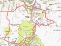 D -
D -No length recorded Not Known Route 13, Gortin Glen and the Robber's Table Gortin Glen is a popular venue for mountain biking competition. This route offers the choice of technical descents within the forest park, with more open mountain tracks in the Southern Sperrins. Start; in Gortin Main St, there is a cafe called the ' Peddlars Rest' at the East end of the village, Grid ref 496 857. Continue east for a kilometre and turn right, climbing South then West towards the 'Scenic Lakes', which are reached in approx 2k. A pleasant diversion can be made on a track around the south lake to rejoin the road, reaching a 'T' junction on the main Gortin/Omagh road. Turn left, and soon after, leave the road to the right on a forestry track on the 'Ulster Way', (also marked as a bike trail), which continues to climb, running roughly parallel with the road. At Crockanard, a choice of narrow single track bike tracks present themselves. These provide a more adventurous descent towards Gormleys Bridge, which can also be gained on the main forestry track. On regaining the road, continue West on the minor road towards Newtownstewart, past the camping/caravan site, past Donnelly's Bridge to turn right at gr 463 827. Initially tarmaced, the track, (signposted ' Right of Way' )climbs steadily towards the 'Robber's Table'. Higher up, it becomes grassy, and can become heavy going in wet weather, as it crosses the broad col West of Curraghchosaly Mountain. Several gates/ stiles are negotiated, before the track descends steeply to join the road at a cross roads. Turn right, and continue, mainly downhill, to Gortin Village. 3 Hours. Mainly forestry or hill track track. Options of technical sections. Map, Sheet 13, The Sperrins' 1;50,0000 View Route Edit Route Upload a new photo for this route | |||
24 - Glenlark
Length: 45m xx Map OSNI 1;50,000 Sheet 13, or Sperrins Activity Map 1;25,000 The Ride It is sometimes said that “The Sperrin mountains are better looked at, than looked from”, being rounded, boggy, and boasting arguably more barbed wire than North Korea. The glens are however lovely, and this route does a traverse above the best of these, Glenelly, via Barnes gap, returning mostly ‘off road’ down Glenlark to the charming sleepy village of Gortin. Visitors are few, despite being starred as one of the top 50 wild places in Christopher Somerville’s ‘Best 500 Wild Places’ in Britain and Ireland . Mostly very quiet, minor tarmac roads (part of the Central Sperrins Scenic Route and Ulster Way) with a gradual descent of Glenlark, first on a forestry road and then on a soft boggy and grassy track*. *This may change as there are proposals to build a big wind farm here. They are currently being challenged by various local and environmental groups. Time.4-4.5 hours Ascent.? Distance. 45 km Approach From Omagh follow the B48 for 14 Km to Gortin Village, and park in the main street. The Route. From Gortin follow the Plumbridge road downhill, cross the Trinamadan bridge, and take the first right. This quiet scenic Gorticashel road follows the course of the Owenkillew River (part of the National Cycling Network) for 6 km to Scotchtown, before leaving the cycle route and climbing gradually to Barnes gap. On gaining the prominent notch in this Sperrin Ridge, bear right at Gr 55150 89400 along the right flank of the hill, and keep right again after a kilometre, at Gr 55500 90350, to gain the Corramore Road, and the ‘Central Sperrins Scenic Route’. And scenic it certainly is, as it weaves its way along an elevated belvedere with stunning views of the beautiful Glenelly Valley below, and its backdrop of the high Sperrins. After about 9 Km at Gr 63400 93950, just above Sperrin Village, fork right and make a steady climb into forestry. Forsaking the tarmac, (and the Central Sperrins Scenic Route), there is a gate on the right at Gr 64700 92900 leading to a level forestry trail which passes on the right the diminutive Lough Lark. Just over 2 km along this track there is a choice of turning left, downhill at Gr 62850 91600 , crossing a bridge and joining another forestry trail leading back to the Owenkillew valley. The other option, is to continue straight on. The track becomes more challenging, spongy, and sometimes pretty hard work, but stays out of the forestry and therefore enjoys better views. Whilst marked on the map, there is at least one place (just beyond a stream) where it becomes hard to follow. After about half an hour, you regain a hard track which becomes the Glencullin Road, and after an initial climb, there is a long delightful descent back to the Owenkillew Valley. You are back on the Gorticashel Road (the other forestry option having joined it about 1.5 Km further back). Turn left at the crossroads, after a short steep uphill at Scotchtown, Gr 54750 87450, back down towards the river to a left turn at Gr 53100 87350. There is an option here to take this left turn (signposted Gortin), cross the river, and turn right, but this is the main road, with a level of vehicular traffic to which you will have become entirely unaccustomed, so I would prefer to follow the Gorticashel Road back to the Trinamadan Bridge and Gortin Village.
View Route Edit Route Upload a new photo for this route | |||
|
Sligo The Dartry Mountains provide a spectacular backdrop to the attractive town of Sligo, and there is a tarmac road to the mast on the highest point Truskmore, which can be combined with a tour of the beautiful Gleniff valley. A must for the visitor is to bike around the shoreline of beautiful Lough Gill (of ‘Lake Isle of Inishfree’ fame) but both of these routes are pretty much all on tarmac, so better on a road bike or hybrid. Add route description here... |
|||
|
Edit note
Upload a new photo for this note |
|||
23 - Lough Navar.
Length: 30m xx Map OSNI 1;50,000 Sheet 17 or 1;25,000 Lough Erne Lower The Ride Don’t be put off by the ‘Lough Navar Scenic Drive’ signage, as vehicular traffic is only permitted on the first section of this route, and the tarmac provided helps to gain the height to the viewpoint/highpoint over Lower L. Erne. The Descent is largely on well surfaced forestry tracks wending their way between remote lakes ,and the section on the other side of the road from L.Navar takes in some lovely, rarely visited, and spectacular countryside. Tarmac or good forestry type tracks. 3.5 hours. Height Gain 300m. Distance 30km. Approach From Enniskillen, approx 9 km along the southern shore of Lower Lough Erne on A46 to Grid 14400 53700, forking left signposted L.Navar Forest Drive. Follow this road for about 7 Km to a car park on the right Gr 07400 54800 with information board, map etc. The route Follow the tarmaced road climbing gradually but steadily past Aghameelin Viewpoint for 5 Km to the prominent and well signposted viewpoint overlooking Lower L. Erne at Gr 06100 57650. .A steep track descends north to the shores of the lake from the viewpoint, but this is not part of our route. Retrace your route for about 1 Km to turn right at Gr 06050 56850, turning right again at Gr 05950 56800 going past a forestry barrier, and off the tarmac for the first time. Allow 1 hour to here, depending on the time spent at the viewpoint. The track beyond is at first level, then downhill, but marked with Ulster Way signage (yellow fern on blue background). Turn right at the T junction and skirt Meenameen Lough, turning left just beyond it. The track then skirts Lough Navar, turning back east and rejoining the scenic drive at Gr 04699 54500. Turn right, descend, and rejoin the public highway at Gr. 05800 54100, about 40 minutes from turning off the scenic drive. ( Less than 2 Km will take you back along the road to the car park giving an outing of about 2 hours) If you wish for something longer, turn right on joining the road, for a short distance (about half a km) turn left just past a bridge over the Sillees River, into the Conagher Forest. A forest track descends past an old quarry twisting its way down to cross a small river, before climbing again to join the road at Gr 06500 51900 (about half an hour). Turn left and follow a delightful rocky valley downhill past a small lake (Doagh Lough) with some crags behind, then continuing to descend towards Derrygonnelly, with views of the big cliffs of Knockmore on the right. Bear left, and continue to the crossroads just north of the village, and turn left beyond the Derrygonnelly Harps GAA ground. Less than 2 Km, you will meet the Lough Navar road, (on which you approached), turn left and climb gradually back to the car park and your transport 3.5 hours approx.
View Route Edit Route Upload a new photo for this route | |||
27 - Breesy Hill Bypass
Length: 26m xx Map OSNI 1;50,000 Sheet 17 The Ride. Starting and finishing in the charming border village of Belleek, this route ascends to a watery wilderness in County Donegal, returning across the flanks of Breesy Hill, (even at 258m, a prominent landmark in the area), on a rough track, before a long pleasant downhill cruise back into Fermanagh and the village. There is a very good thatched coffee shop, and several friendly hostelries in the main street. Mostly tarmac or forestry standard track, but with approx 1km rough open country (with only the vague trace of the road that was marked on the map). This can be avoided by taking a parallel road. Time 3 hours. Height gain 320m, Distance 26km Approach From Enniskillen follow the A46 towards Ballyshannon, turning right beyond Lower L.Erne into Belleek Village. The route From the village centre follow the main Kesh road eastwards for just under 4 Km to Gr 98100 59800, just before a right hand bend, and turn left, off this busy thoroughfare. Follow this narrow road around the northern shores of Lough Scolban ( this is also the current route of the Ulster Way) turning left at a T junction at Gr 00900 61000. After about 1 Km, turn left uphill at Gr 01650 61750, ignoring the fact that it is marked as ‘No Through Road’ on signage. (If you don’t fancy a bit of ’off road’ and probably wet feet, continue to where the minor road you are on, rejoins the main Kesh road, and turn uphill there). The wet feet candidates continue past Tullyderg and Lower Curragh before the road become a track, descending for a short period into swampy oblivion, before rising again and skirting some trees on their right hand side. Soon a thin path leads into an old farmyard and rejoins the road that the dry foot brigade will have chosen. Horizons are suddenly broadened as this elevated remote road skirts a lough, and signs appear to explain to the very odd German, who might choose this way to enter the republic, that he must drive on the left. The road climbs past Lough Vearty to a cross roads where a sharp left is chosen leading along the shores of Lough Tullynasiddagh. Keep left at a fork* and soon this becomes a cart track which climbs across the eastern flanks of Breesy Hill. A ruined farmhouse is passed, with a nearby abandoned mobile home, before the track turns west, and distant views emerge of Ben Whiskin and the Dartry Mountains near Sligo. Ignoring all turns, tarmac and human habitation will make a gradual appearance, and you reach a junction at Gr 94000 61900, Garryderg, where you turn left, downhill. Mostly freewheeling from here, and about 3 Km later ,the village of Belleek is regained. * Another alternative is to turn right here, visit some more lakes, before turning left at Kieby, Gr 93000 65000, and rejoining the described route at Garryderg. View Route Edit Route Upload a new photo for this route | |||
28 - Gleniff and Truskmore
Length: 27m xx Co.Sligo Map OS 1:50,000 Sheet 16 The Ride A circuit of, arguably, the most dramatic valley in the Dartry Mountains by the ‘Horseshoe Road’, including a climb to the mast at the summit of Truskmore, 647m. Terrain Mostly tarmac, but includes a climb to over 2000 feet, so not to be underestimated (if you intend to include Truskmore). Time 3-3.5 hours. Distance 27 km. Ascent 700m. Approach From Sligo on the N15, towards Donegal Town. One Kilometre beyond Cliffoney, there is a car park at a crossroads Gr G 718 546. The Route At the crossroads go right (south east) for just over 4 Km, with increasingly impressive views of Ben Whiskin’s wavecrest ridge, rearing up ahead. At G 738 503, turn right at a crossroads at Keelogues, cross a bridge and go immediately left. The road climbs gradually through forestry (The Horseshoe Road) for 3 km, with Dairmuid and Grainne’s Cave high above on the right, before being forced east by the precipitous end wall of the cirque. Crossing a river, the access road to the mast heads up right, climbing steadily for about 3 Km to the highpoint of the Dartry Mountains ( and this guide) at 647m. Pause at the summit to admire the view (if it is clear!), across Donegal Bay to Slieve League. Watch out for potholes on the descent, (and the odd sharp bend), and turn right on rejoining the Horseshoe Road. Continue down the east side of the valley past Clogh, for about 3 km, to an old mill site now used as a recreation area. Cross the road to a gate opposite, and take the track over an old miners’ dam, turn right and descend a short distance back into Keelogues. This time turn left, and then after a kilometre right, to a T junction. Right again for a short distance to a cross roads, then left into Cliffoney, where there is an opportunity for refreshments. Your car is less than 2 km further north on the N15.
View Route Edit Route Upload a new photo for this route | |||
14 - Aine's Route
 D -
D -Length: 29m Aine and Valli? Route 14, Aine's Route. This is a nice combination of coast and mountain, starting from the lovely thatched pub/restaurant at Aughris Head, and taking in the part of the Sligo Way that traverses the North side of the Ox Mountains, just West of Ladies Brae. Follow the N59 from Sligo towards Ballina, and turn right just beyond a chapel at Gr 534 332 following signs to Aughris head and the' Beach Bar'. Park at the pub, grid 507 359, an idyllic situation. Start, at the thatched 'Beach Bar' pub and restaurant, and head back inland (South) to a T junction (2k), turn left, and take the first right to a staggered cross roads on the N59. Cross, and follow the minor road uphill, past a dramatic kink, to join the Sligo Way at Gr 509 303 (yellow arrows). Turn right, and traverse the northern slopes of the Ox mountains in a Westerly direction, losing and then regaining height, until it becomes a track on the SW climb up Kings Mountain. A wind farm appears, and the track suddenly levels off as you join another, turning west, and descending. At Dunowia, keep right of the gate, and follow the yellow arrows downhill, to take the first right at Gr 460 298, and first left at Gr 470 300, down a farm lane. This finishes at a gate at Grangemore. Cross this, and go left, onto a grassy boreen down a short narrow valley to regain the road at a farm yard. This is followed downhill, and right, to cross the N59 at the Chapel at Templeboy. Just over 1k( and a dogleg) later, the coastal road is reached, turn right, then left at KIlrusheighter towards Aughris Head. This will lead back to the thatched pub. 2.5 -3 hours, 28.6 k. OS 1;50,000 sheet 24. Mainly quiet lanes and roads, very short section on grass. Difficulty- green (nothing technical). View Route Edit Route Upload a new photo for this route | |||
29 - Union Wood.
Length: 16m Valli Schafer Sligo. Map OS 1:50,000 Sheet 16 Contributor Valli Schafer. The Ride This is a beautiful wood very convenient for Sligo, and popular for walking, cycling and many other activities. There are a number of custom trails built and maintained by the North West Bike Club, which could be incorporated into this route making it a lot more technical. Terrain Mainly good forestry roads and well surfaced paths, but with one tough, rocky, boggy and technical section. Time 2 Hours Distance 15 km Approach From Sligo follow the R ? south to the roundabout at Collooney where is a filling Station, and turn left, and immediately left again and park at the Gourmet Café, which can be seen easily from the main road. This is a good place for refreshments before or after. Route Cycle out to gate and turn left, following a narrowing road, which becomes a forestry track as it enters Union Wood. Take the first right through a gate and begin a stiff climb up a broad track which weaves its way uphill through the trees. Turn left at the first crossroads and follow the, now level, track past some outcrops on your right, circling around the hill to rejoin the main track at a T junction, Turn left, downhill, and go straight through the next cross, continuing to meet a barrier and the tarmac road. Cross with care to another track, as there is a blind bend nearby, and fork left immediately on a track running close to, and parallel with, the roadway. At a turning area the track swings right, uphill, and follow this on grey screenings to where the track turns sharply right, again uphill. Only metres before this there is a log across the ditch on the right, and a narrow stoney path beside it, which goes uphill becoming increasingly difficult to cycle. At the top, great views open up of the Sligo area, as you clamber back in the saddle and attempt to make your way across this rocky hilltop on a choice of faint tracks towards a line of pylons. Just before reaching the pylons you will join a more distinct cart track going downhill, on a combination of stone slab and mucky sumps. Enjoyable but pretty challenging, it joins the cinder track of the Sligo Way, which is zoomed down to the roadway crossing again. You can return directly through the wood, (without the need to circumnavigate the hill again), or turn left at the point/ crossroads at which you took off around the hill, and take a custom built mountain bike trail on your right, which will bring you to the same place, should you survive. View Route Edit Route Upload a new photo for this route | |||
18 - Miners Way
Length: 15m Contributor, Valli Schafer 2013 Route 18, The Miner's Way A superbly varied route, both in terms of terrain and scenery, possibly the best in the Sligo area. From Sligo follow the R284 to the village of Geevagh 837 168, turn left and park outside the GAA club. Return to theR284, turn left, and take the first left again to join the Miner's Way. Soon the track becomes gravel and stone as it zig-zags it's was up the hill, passing St. Elva's grave on the right. An extended, but never too steep, 300m climb, finally leads to the top, where it joins a new windfarm road. Turn left and follow the track, sometimes on bare rock to a fork at Gr 8755 1730, where a short descent to the right is made, under an undercut cliff, with old mine workings in it. This leads to more bare rock track, becoming a cart track, which joins the road at Gr 872 184. Turn left on tarmac, and regain the hiil crest, before a long pleasent descent of about 4k to the cross roads at Tap 835 190. Left again by Carrowcashel to an old farm cottage at the end of the track 843 188. The boreen beside the cottage is blocked by an ancient abandoned tractor, but push past it and a couple of bushes beyond, and follow the boreen onto the forestry track. This continues to a fork at Gr 854 183, where the right hand, and mercifully downhill, option is chosen to join the minor road high above Geevagh. Turn right and zoom down the hill, and back to the car. The little pub in Geevagh is not to be missed (on the east side of the R284 with a Guinness sign outside). It is a wonderfully original grocery bar, of a type rarely seen any more. 2.5 hours, mainly tracks and trails, Map 26, Distance 15k approx View Route Edit Route Upload a new photo for this route | |||